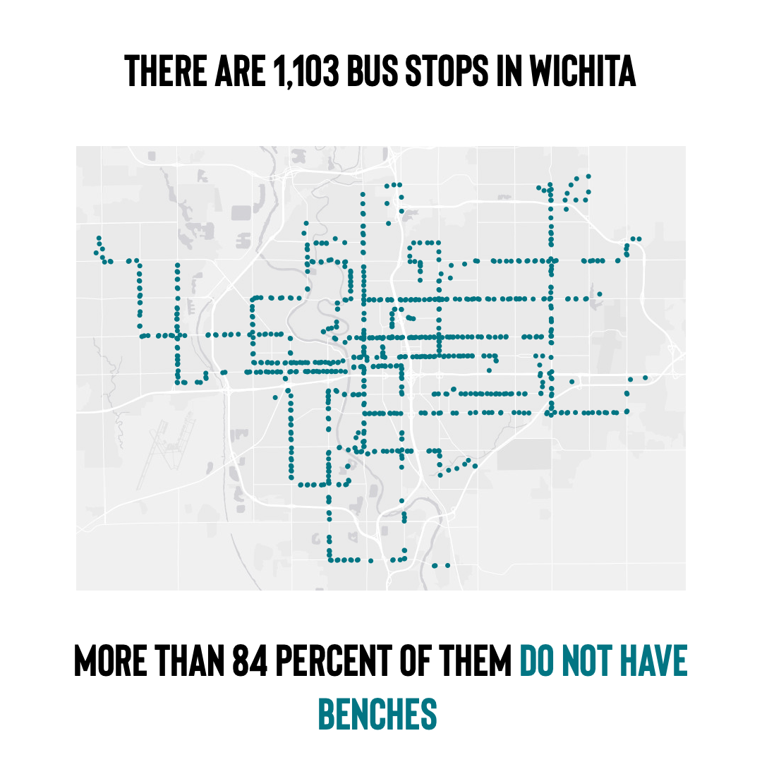
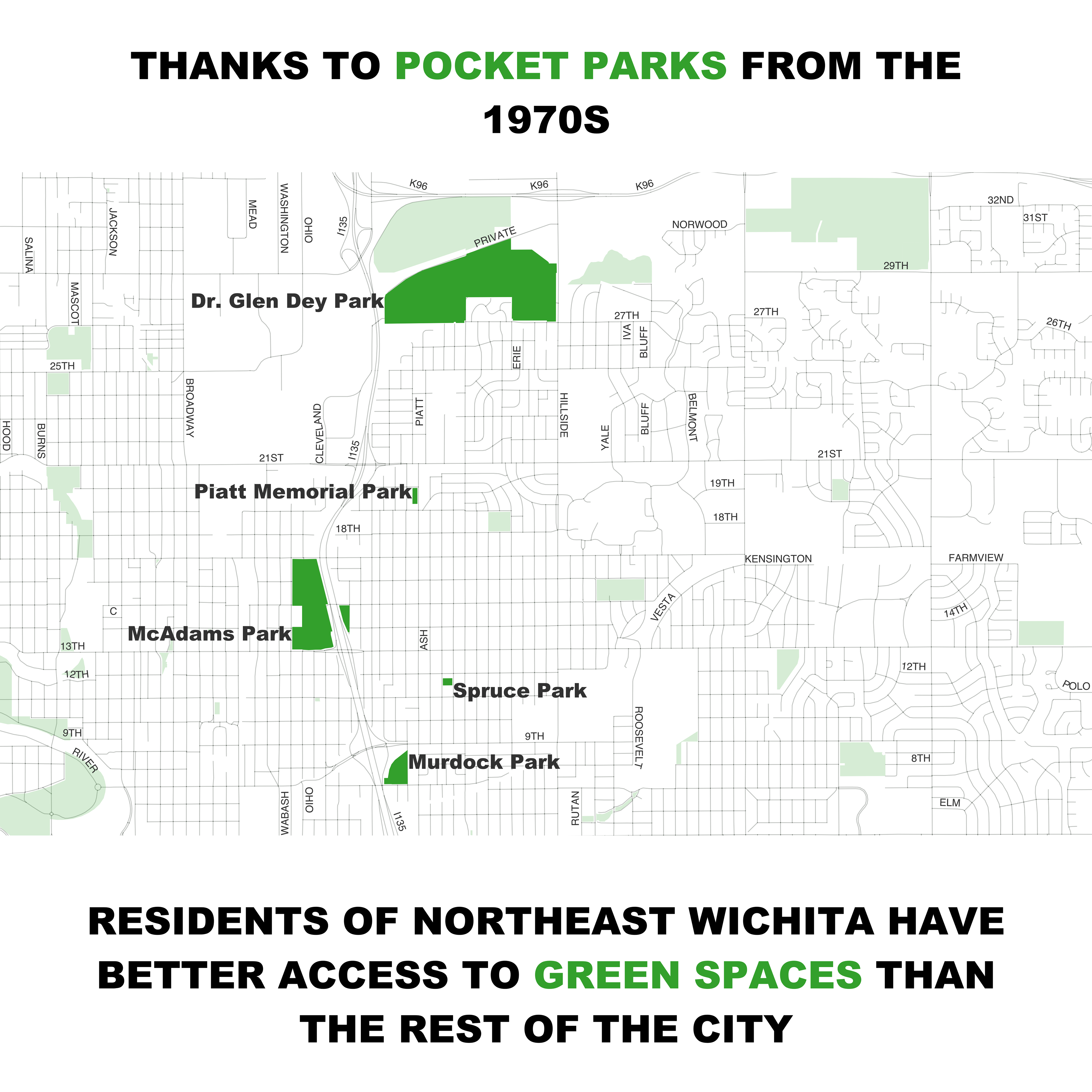
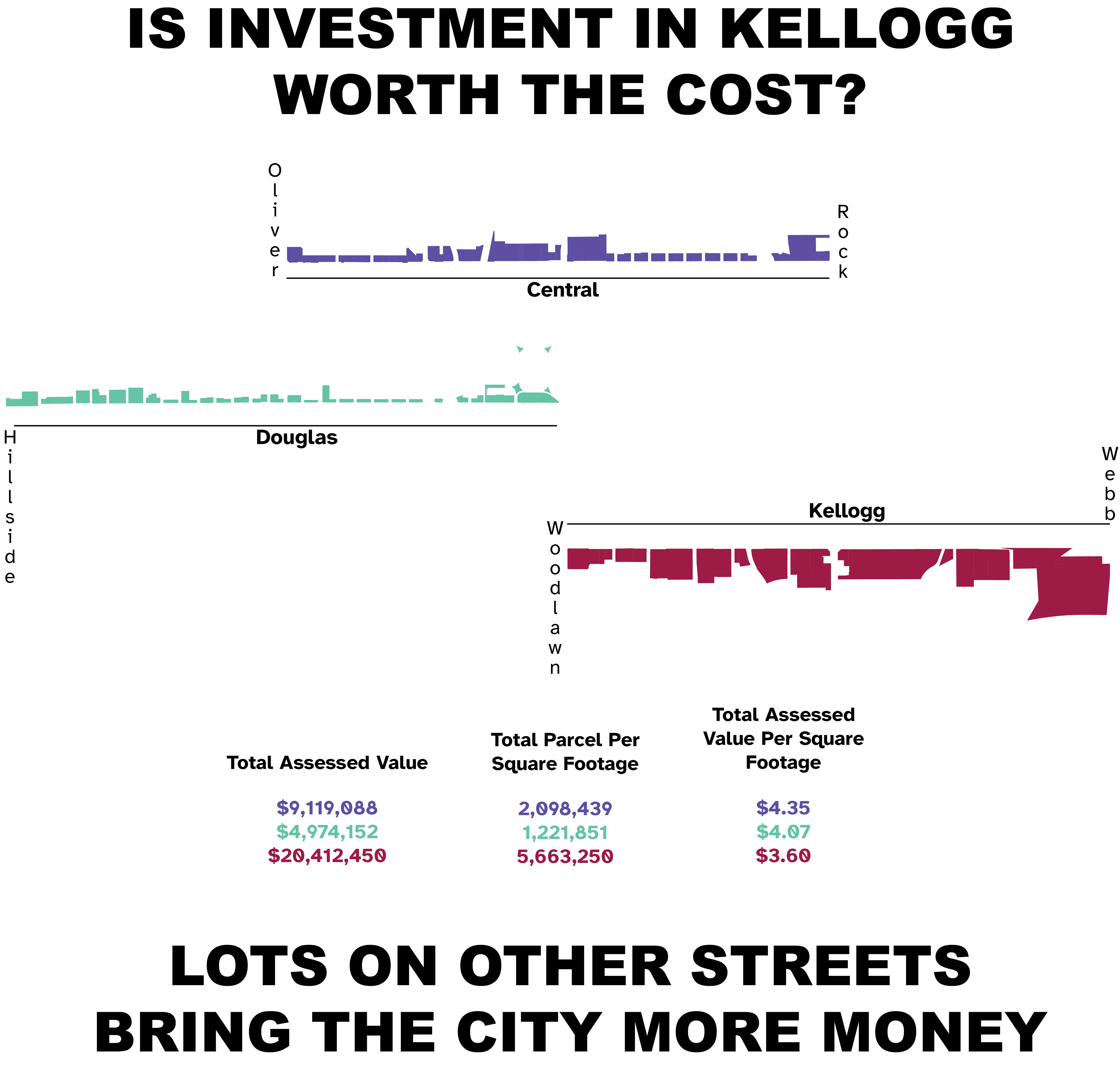
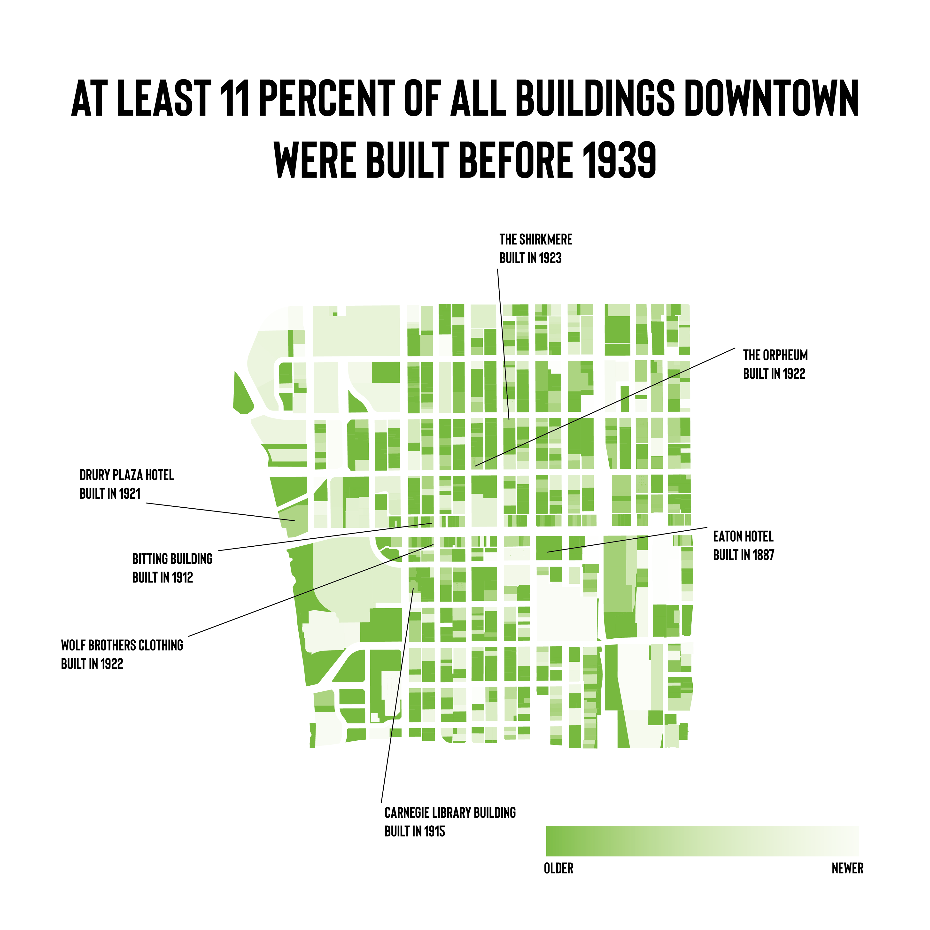
About
Walkability in Wichita
Music in DC
Band Maps
About
Walkability in Wichita
Music in DC
Band Maps

Walkability in Wichita

In 2025, I worked alongside Alan Kailer of Bike Walk Wichita to create an article series that focuses on what urban planner Jeff Speck calls "walkability rules." Each article highlights a rule and tells a history of how they were both implemented and undermined by planners, traffic engineers, activists, and regular people within the city.

These are some of the maps that I made in conjunction. I rely on, among other sources, open GIS data published by Sedgwick County and the City of Wichita. Analysis is conducted primarily with GDAL and SQL while the maps and graphics are made using QGIS, Adobe Illustrator, and Seaborn.
read the series here